Tag Archives: Hiking

Climbing Longs–Getting There

Our journey towards Longs Peak began at 2:30 am. That’s 2:30 am at the trailhead! We were not the first ones there at this time of day as this is a relatively busy trail in the summer but you must start early because it is a long and challenging trail with rain/snow/thunderstorms possible during the afternoon. We began the trail half asleep and unsure of what lay ahead but there were several others here in the same situation so up we we go. Surprisingly it was quite warm at almost 60 degrees F at the start of the trail. I was expecting temperatures in the 40’s during this time of night so off came the jacket before even starting as 60 degrees F is very warm for this strenuous of hiking.

Getting ready to hike to Longs

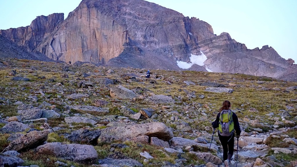
The entire trail to the summit of Longs Peak using the Keyhole Route is about 7.5 miles long each way with most of that trail needed just to get to the Keyhole. This takes you from the trailhead, up through the trees before reaching the alpine environment above the tree line, and around Mount Lady Washington. Hiking this distance on easier terrain is not terribly difficult for me and I’ve been preparing for this for several months, as you can read here, however this is continually hiking up, often time over steps, rocks, and tree roots, at a fairly steep incline. Even at that, the hiking was not as challenging as I expected which was a nice surprise. The difficulty came with the altitude. Above 10,000 feet, breathing becomes more difficult for me slowing down the pace in order to get adequate oxygen to continue on.

Longs_Peak_map

As we reached the tree line and began hiking in the tundra we got our first view of Longs Peak from closer up. It was a beautiful moonlit morning with the full moon hovering just above the mountain giving us a perfect outline of where we were headed.

Hopefully this is making sense because there are thunderstorms with a lot of lightning as I’m writing this causing distractions.

We took a few minutes to rest and enjoy the surroundings. It was fun to see all of the little lights bobbing along the trail both ahead of us and behind us. Like a little hiker road. While taking this photo the camera low battery symbol began to flash and I realized I forgot extra batteries for this camera and didn’t charge the batteries for the GoPro so taking a lot of pictures was out. This bummed me out because when am I likely to be here doing this again? After coming to terms with my lack of picture taking ability we moved on around Mount Lady Washington.

The first view of Longs Peak with a full moon just above

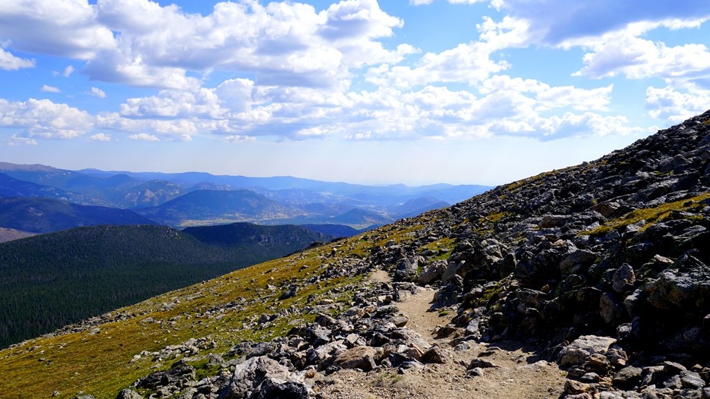
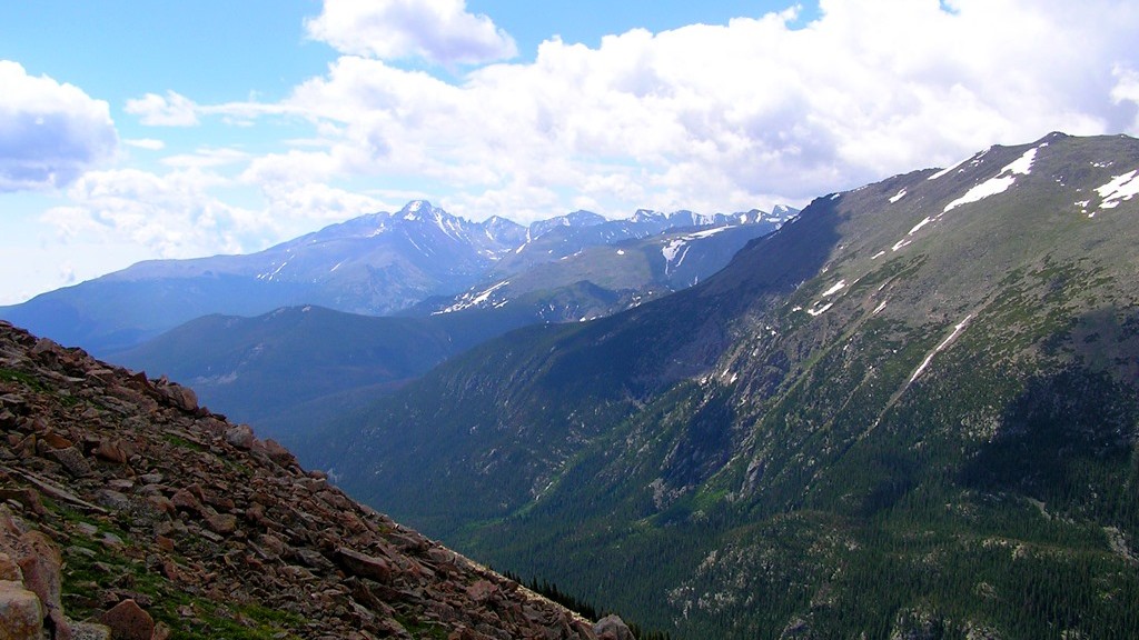
Almost around Mount Lady Washington and to the boulder field, the sun began to cress the horizon giving us an amazing sunrise way up on the mountain. A sight I hoped to see since preparing for this hike. It took my breath away! Maybe that was just the altitude while hiking. At this point people had created a relatively smooth trail placing stones together to create a sort of sidewalk making it more of a walk than a hike for a little distance. What a nice reprieve from steps and stones! Thank you to whomever did this.

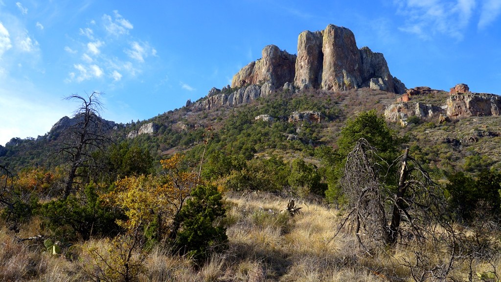
With the sun rising we got our first good look at the mountain we were aiming to climb which is the main photo above. Surprisingly it didn’t look as insurmountable from here as it did from Flattop Mountain and other areas around Rocky Mountain National Park. We’ll see if that stays the case once we get there. Off towards the right I could see the Keyhole which has been the first goal of this hike. Anything after that would be a bonus. A short time later we arrived at the Boulder Field Campground and took a much needed rest before climbing up into the Keyhole. Yes, there really is a campground up here.

It took us about 5 hours to reach the campground and we traveled about 6 miles to this point. Feeling the strenuous hike it felt nice to sit for a little while and take in the views while mentally preparing for the next part. In my research it was said that this is the easy part of climbing Longs Peak. It didn’t seem all that easy to me! What are we in for next? To read more click here…..

Sunrise on the mountain

Exploring Flattop Mountain

Back in 2009 we visited Rocky Mountain National Park to hike to Flattop Mountain Trail and we did that successfully. Unfortunately that was done after a long day of exploring so there wasn’t much energy to continue further. I’ve wanted to attempt the trail again if the opportunity presented itself. Well, recently we made the opportunity happen and once again found ourselves on the trail. Surprisingly the beginning of the trail looks very different from what it looked like seven years ago as proven in the next two photos.

Flattop Trail in 2009

Flattop Trail in 2016

The top picture was taken in 2009 and the next one taken just a few weeks ago. I can find now similarities to them which made it a little challenging to begin this hike since there wasn’t really recognition of the beginning of the trail causing me to question if we were on the right path or not. Especially since it was still dark when we got to this point. Trusting in the trail signs we pressed onward towards the top.

Flattop Trail Head when we began our hike from Bear Lake

Our hike on Flattop Mountain began at 4:30am as we passed Bear Lake. The scene is pictured above. In the dark, armed with flashlights, our journey on this mountain trail began to climb towards to top. In a short time we began to see light on the horizon however the trail swallowed by trees continued to be dark requiring artificial light sources to make our way over rocks and tree roots as we went up, up, up, to the sky.

Sunrise from the mountain

As we continued on this trail we could begin to feel the effects of the ever thinning air making it more difficult to breath and hike at a fast pace. Increasing our breaks while we trekked higher the trees began to decrease in size indicating the approaching tree line where they can no longer grow in the cool mountain air. Daylight finally penetrated this forest trail just as we broke above the trees bringing spectacular views of the mountains surrounding us with Emerald lake in the valley below. Our climb began below this lake and now look how high above it we are. Progress.

Overlooking Emerald Lake

Marmots appeared from the rocks in the mountain to greet us as we passed their homes. They made for a more interesting hike once reaching the tundra of the alpine zone on Flattop Mountain. Watching as they climbed in and out of boulders and finally on top of them to grab the warmth of the morning sun before gathering food for the day was extremely entertaining.

Marmots came out to greet us

They would definitely not be outdone by their smaller tundra mates – the Picas. These smaller alpine mammals would give a sharp squeak but would not always come into view as they moved between the rocks and boulders. If you watched long enough there would be a glimpse of movement and out would come one of these soft Picas running across the surface as they gathered portions of plants to store in their nests giving another squeak as if to say good morning while we passed.

Picas roaming around on the tundra

After several hours of hiking and a number of breaks to catch our breath we reached the summit of Flattop Mountain. I always imagine mountains as these immovable pieces of solid stone reaching towards to sky. It surprises me as we walk the top of the mountain that the top is scattered stones and boulders showing they are not as solid as originally perceived. The elements continue to work on these mountains breaking them apart slowly over time. For now it’s a great challenge to climb to the top of these massive rock formations.

Reaching the top of Flattop Mountain

In our picture above you see Hallet Peak to the right which is the next mountain over and one we briefly discussed climbing but decided this was enough for today as the real  challenge rests in the left of this photo – Longs Peak. A hike for another day. With our goal achieved for today we spent some time exploring and taking in the sights of our amazing surroundings, and watching some of the animals as they went about their business for the day.

One of the vast views from up here

After a little rest and energizing food we ventured to the nearby Continental Divide Trail. I’ve read about people hiking this entire trail covering over 3,000 miles from Mexico to Canada and wanted to walk a little of this beautiful trail. There were large cairns marking the trail most likely to show where it is during the spring and fall when snow could cover it making a more challenging hike and increased likelihood of getting lost. Further exploration on the CDT was tempting but it was time to head back down the mountain. With our destination successfully found we began the descent back to Bear Lake.

Exploring the Continental Divide Trail


Preparing for a Rocky Mountain Hike

Since exploring Rocky Mountain National Park in 2009 I’ve wanted to return as it is such a beautiful place. Our last trip was to hike to Flattop Mountain Trail which is the location on our National Parks Monopoly Board. In 2009 we made it to the sign and returned to the car. I’ve always felt that I would like to hike the trail in its entirety someday.

Flattop Mountain Trail

That someday will happen this summer. Or at least we are going to be back in the park and hopefully the weather cooperates allowing me to hike to the top of Flattop Mountain which is a 10 mile hike round trip. Typically 10 miles isn’t a concern for me but it gets a little more difficult with the incline/decline and altitude in a mountain setting. Flattop peaks at just over 12,000 feet altitude and while this has an impact on me it wasn’t very bad the last time I was at this height.

Look at the beautiful surroundings

In addition to Flattop Mountain I’ve added in the challenge of hiking to the top of Long’s Peak which is a 15 mile trip and tops out just over 14,000 feet in altitude. A few years ago I would have never considered doing this as I’m not in physical condition to do so. After reading a few long distance hiker’s blog I began to consider it and figure out what it would take for me to do.  The idea of hiking to the top of the tallest peak in Rocky Mountain National Park, which I’ve looked at from an airplane, and see it from the other direction is a challenge I want to take on.

In order to be successful at these hikes I’ve been in training since January to build my legs and also try and increase my lung capacity as much as possible to prepare for the thinner air at higher altitudes. This training has included hiking several miles at a time carrying a 45 pound training pack which is at least double the weight of what my actual backpack will be. Hopefully the actual pack will feel quite a bit lighter so I don’t mind carrying it for a much longer distance. The training pack also put a heavier load on my legs building those muscles a bit more.

One of my practice hiking trails

Additionally I’ve been working with inline skates and biking with the occasional walking up and down stairs for 45 – 60 minutes with a loaded backpack on. Some days have been more challenging than other to go work out just like it is for anybody. In January I would go out on the trail even at temperatures of –12 degrees F and in the summer heat and humidity when I would return home so full of sweat I looked as though I had jumped into a lake. During these time I just needed to think about climbing mountain trails and my motivation would quickly return and I could walk faster or pedal harder forgetting about the conditions I was training in.

Biking on the trail

The time has come to see if all of that training will pay off in the form of an easier and successful hike. Certainly some of the mountain trails, especially near the top of Long’s Peak, have been a little intimidating but I’ve seen enough video and photos of the trail and have enough confidence in my abilities that as long as the weather remains favorable I’ll make it to the top.  If the weather does not cooperate than the risk does not become worth the reward of summiting Long’s Peak and I will turn around which is why the planned start time is around 2:30am to increase the odds of completing my goals. It’ll be fun either way I’m sure as there is nothing but amazing scenery all around.


The Lost Mind Trail

This is what we would call the trail but the real name is Lost Mine Trail which is in Big Bend National Park. It’s listed distance is 4.70 miles however my hiking app registered 5.30 miles round trip. The difference could be all the little side trails to see different views we ventured on that all added up to the extra half mile.

Lost Mine Trail map

We drove a short distance to the trailhead and as soon as we emerged from the car we were in awe of the incredible views surrounding us bringing energy and excitement to get on the trail and climb higher to see even more vistas. This was a trail that was most recommended to us and the trailhead views lived up to those recommendations but could the rest of the trail compete with these amazing sights.

The rocky Lost Mine Trail


Fortunately the trail is well traveled making it easier to follow but it’s littered with rocks to step over so as long as you are capable of walking at an incline for several miles while carefully navigated over and around the rocks. Staying on the trail in this climate is very important in preventing severed erosions during heavy rains which can wash out portions of the trail. These ‘shortcuts’ are tempting but not worth the potential damage for those hiking another day.

As the trail climbed up, the views became more impressive

As the trail continued higher and higher the views continued to be impressive making for distracted hiking and slowing down the pace to get to the top although a water break from time to time is a good idea allowing you to stop and view your surroundings. In addition to the desert mountain scenery we were confronted with cactus’s beginning to bloom adding to this great trail experience.Yet another distraction pulling attention away from getting to the top of the mountain.

Cactus's beginning to bloom

At different points along the way we were joined by other critters, mostly birds, looking as though asking how our hike was going and if we were enjoying the trail. Yes we were having fun for the most part. Unfortunately one of our group had inadequate footwear making the stones on the trail feel as though piercing into their feet with each step. If that’s the worst part than it’s a successful hike.

Mexican Jay joining us on the trail

Arriving at the top the trail levels out providing a sense of relief from continually climbing up, up, up towards the sky. Time to sit and taking in the vast mountainous landscape on this bright, sunny morning and join the others doing the same thing. While taking in the views I got the first opportunity of seeing a road runner closer up just before it decided to jump off the ledge and out of sight forever.

A road runner just before it plunged over the edge

The top of the Lost Mine Trail is actually quite large allowing many people to take in this high point without really creating problems moving back and forth among the boulders. There are many different view points to take in all amazing each to their own making this a nice way to spend an hour and possibly even enjoying a picnic surrounded by rocks and boulders rising from the ground. Watching a sunrise or sunset from this location would be breathtaking I’m sure as long as you’re not alone and with flashlights because the hike to get here or leave here would be in darkness. And ohh yah, there are these little things called mountain lions which tend to be more active during these times.

Taking in the views at the top of the Lost Mine Trail

During most of the time on top of this trail I kept looking at this rock which kind of looks like Homer Simpson and wondered how to climb up to the gap under his chin. I just couldn’t find a good path and without ropes it didn’t seem safe to both get there and climb up the rock. After spending some time exploring the area I decided it wasn’t a safe venture so kind of gave up on the idea. What kind of example would that be for the kids?

A little rock climbing along the way

By the way, challenge accepted.

For more stories of Big Bend you can read posts on the Rio Grande and Window Trail


Window Trail

Entering Big Bend National Park

Our Monopoly board brought us to explore Window Trail which lies inside of Big Bend National Park. This is a moderately difficult trail which covers 3.6 miles in total and covers some beautiful scenery along the way. We were fortunate to be there during the spring when many plants were beginning to bloom and the temperatures were ideal for a hike in the desert. Not to cold and not to warm.

Walking through the desert

Along this trail we enjoyed a number of great sights including Yucca’s and cactus in bloom, a couple of white tail deer, colorful birds, and a friendly road runner. This trail follows the bottom of a canyon most of the way where water drains during heavier rainfalls.

Taking a quick break on the trail

About halfway to the end of the trail we decided it was time to explore a place to take a few minutes to relax and take in the great desert mountain scenery. What’s the first thing kids want to do when stopping near rocks? Well climb them of course and this we did as some of the nicest seats were higher up. This is not recommended by the park although we were definitely not the first ones to do this as I found an orange peel in one of the crevices left by a previous climber.

Window Trail through the canyons

Once entering the canyon portion of the hike there were stairs built to make the trail easier to traverse as during other times of the year there can be water flowing through here which is, of course, the way this canyon was created.

The window where the trail ends

At a couple of points along the way we wondered if we were at the end of the trail. I can say definitively now that the end is very obvious because of seeing the window it was named after and it drops off to the desert floor very abruptly. I’m not sure a person would survive a drop from the window.

Rocks smoothed by years of water and debris sanding them down

As you get close to the window the rocks become extremely slippery due to the running water carrying debris which has sanded down the rocks giving them a polished appearance and feel. It was interesting, especially in this dry season, to see how high the water can get in this canyon and how fast it must rush through to wear down the stone underneath.

The end of the trail with a steep drop to the desert floor

Carefully climbing near the end there is just a narrow slot with a large drop-off which is all very slippery requiring some care to get to. It would be interesting to see this area from the other side after a heavy rain. There must be an interesting waterfall for a short time.

A road runner encounter on the trail

During our trek back we encountered this road runner that didn’t seem to care we were there as it walked right next to us on the trail. Other hikers behind us had the same experience. This particular bird must be use to hikers on this trail and understand prey can be found scurrying as hikers pass by making them easier to find. It gave us the opportunity to all see a road runner finally as each time before the birds would be gone before everyone could see them running across roads in front of the car.

Lewis Falls Trail

After a full day of hiking in Shenandoah National Park, it was time to retire to our cabin and get ready for our evening meal. The only thing was that the forecast for the next day was for clouds and periods of rain and we had one hike left to do in our short time in Shenandoah – Lewis Falls Trail. This was the most important of our hikes in this great national park because it was the trail on our National Parks Monopoly board. It was decided then, another hike that was longer and covered more altitude than the others we had completed earlier in the day.

_DSC0427

This trail is 3.3 miles round trip from our cabin and back again. It’s not the distance that makes it more challenging, it the 1,000 feet of altitude that you change from the start to the waterfalls and then you have to climb that 1,000 feet again on the way back. To make things a little more challenging, we wanted to get back before 9 pm when the nearest restaurant closes otherwise there is not really a place to get food after a full day of hiking in Shenandoah.

Looking over the top of the Falls

The trail starts out relatively flat and easy to hike but eventually that drop in altitude finds you and it starts going downhill quickly. Downhill is easier but remember to watch out for roots and rocks in the trail that could trip you. We made it to the falls in pretty good time passing only a couple of other hikers on the way. Lewis Falls

Lewis Falls is a nice waterfall and one of the highest in the park at 81 feet tall but at the time we were there the stream going over the cliff is not very large compared to several other waterfalls in the park. Getting a good view during the summer is a little more challenging because parts of the waterfall are covered with leaves and the steep cliffs around it make for getting a different and better view difficult. Still, I enjoyed this waterfall and the adventure to get to it.

Our Wildlife Encounter on Lewis Falls Trail

Due to time restraints and wanting to get back before the restaurant closes we didn’t spend much time at the falls taking it in. Also, we weren’t well prepared to be on the trail after dark so we needed to do the most difficult portion of our hike at a faster pace. Along the way back we encountered a deer taking the trail toward us which was kind of fun to see but delayed our return both because of wanted to observe the deer and not wanted to chase it. After awhile of watching it decided to meander off the trail allowing us to pass and continue our trek up the mountain. We were all really tired and hot after this hike but we did manage to get something to eat before total darkness enveloped the area.

Dinner in the Big Meadows Lodge

Oh Look… A Park–Pokegama State Natural Area

_DSC5961

Recently we stayed in Superior, Wisconsin while in the area for a wedding in Duluth, Minnesota. The wedding took place on Friday night allowing time on Saturday to do some exploring. While planning this trip I came across a state natural area about 15 minutes away from our hotel and thought it looked like a nice scenic drive during the peak of fall colors in that area. Saturday morning I was laying in bed awake and it was still dark out. Well, getting back to sleep was a near impossible task for me, why not take this opportunity to get to Pokegama Wetland State Natural Area around sunrise and see if there is anything wondering about. By the time I arrived daylight was already showing up. A windy and cloudy morning told me the likelihood of seeing much for wildlife was little but the scenery was still worth the effort.

Beautiful Fall Colors

While driving in this state natural area I came upon a couple of trails. this was a little unexpected as they didn’t show up while reading about this spot. The trails are more for skiing than hiking. Still, they are there so why not use them. Turns out, there are a number of trails going through this area I didn’t know about. I’m a sucker for a good trail with nice scenery and a chance to see wildlife. Someplace else to explore if I’m in the area again. The original plan was to drive through this state natural area, stop once and awhile to take pictures and be back at the hotel to grab breakfast with everyone else. Ahh, the best of plans.

One of the Trails

Once on the trail I was making good time but the lure of what’s ahead kept motivating me to go further. Getting back in time to have breakfast with everyone else soon disappeared along with being back in about an hour. As I was making my way back to the car I took a wrong turn and did a loop back to trails I had walked earlier making the return that much later. Still, the fall landscape in Northern Wisconsin was more than enough to make this excursion worth while.

The Fall Landscape of Northern Wisconsin

Experience Gained: Taking note of the time and direction at the start of the hike using a compass or GPS if there is signal makes getting back to that spot  easier. Also, the speed of hiking easier trails is considerably faster especially when I’m the only one hiking. Not that hiking alone is my preference. Sharing the experience is important to me.

Some of the Wetland Areas

Gorgeous Fall Colors

A Memorial Weekend Hike

Among the Mississippi River Bluffs

During the holiday weekend at the end of May we were camping in the Bluffs near the Mississippi River. Since it was a later spring the water temperatures were colder than usual, it was cloudy and cool so the fishing would likely be slower than we wanted. After a little research we found a couple of trails near by and decided to go for a hike in the bluffs and see if we could find an great view or two.

A Forest Valley

The forest was so lush and green with a number of beautiful wildflowers beginning to bloom.

Wildflowers in Bloom

This was a 7 mile trail so a little longer hike than we’ve been on before but without any gear should be achievable. Expecting we should be able to hike at a 1.5 mph pace it was expected to take about 4-5 hours total to complete this trail including time to eat and enjoy the views while taking pictures. Past experience taught us to bring along food for a meal as well as a few snacks and water.

The ATV Trail

As we arrived at the park we found out that this is mostly an ATV trail and very few people actually hike it. As a result the trail was quite muddy in places and we needed to keep a watch for ATV’s as there were many using the trail that weekend. The first half of the trail was lacking much for vistas that we were hoping to see and included a couple of steep hills both up and down to climb. Fortunately the blooming wildflowers and seeing a scarlet tanager made this part of the trail worth the effort. This was the first time I’ve ever seen a scarlet tanager.

A Scarlet Tanager

Growing a little tired of hiking after walking up the bluff for a second time we were just hoping there were no more major hills to climb down and back up again. Shortly we came upon the first of a couple of locations that over look the Mississippi River and surrounding  bluffs. It was at this point we achieved our main goals of this hike which was to see this amazing part of the country from within the top of the bluffs. Here was a view from an area we had not witnessed before.

River Panorama

After taking in the views it was time to head down off the bluffs to the trailhead. If time permits a trip to the locally famous Nelson Cheese Factory for some great ice cream was in order. With that motivation the pace was increased to get back to our cars and head towards our camping location.

Nearby Bluffs

For those who are curious, we did make it in time to get our ice cream.

Experiences Gained: Longest hike yet in one day gaining confidence to tackle more difficult hikes on Isle Royale and the Rocky Mountains someday hopefully soon, Saw several scarlet tanagers which are a beautiful, vibrant red  bird that migrates to this area for the summer, and enjoyed views of the river and bluffs new to us.