All posts by Troy

The Ducks are Migrating

While out on a hike recently I noticed this small pond full of ducks. Watching for a few minutes I could see a few different types of beautiful ducks but I had to keep going as rain was near and I didn’t really want to get wet. A few days later I got up just before sunrise and headed to this lake to watch these ducks.

A crisp morning with some fog

As the morning went on I was amazed at the diversity of ducks in this little pond on a beautiful crisp day. While walking from my car to the pond there was frost on the grass and some fog in valleys which was burning off quickly under the warming sun. A perfect morning for enjoying the outdoors in my book.

Ringneck Ducks

After settling in next to a tree, the ducks began moving around the lake but seemed to always keep an eye on me. The morning started with me sitting in front of the tree trying to keep still waiting for them to come closer. After awhile I decided to move next to the tree instead of in front of it and ducks began to come closer but still far enough away to prevent close up pictures like the Ringneck ducks in the photo above.

Trumpeter Swan grazing the top of the water

While enjoying the great spring morning I could hear a Trumpeter Swan calling off in the distance. Eventually it flew closer and around the pond. Having watched these birds I was pretty sure it was going to make a pass somewhere on this pond if not land in the pond so I kept an eye on it and had the camera ready. The difficult part about preparing for the swan was trying to also keep on eye on the ducks and their position. Soon this Trumpeter turned and headed for the pond allowing me to shoot away. When looking over the photos this one caught my attention because of how close the wing feathers are to the water and the light reflecting off of the water onto its wings.

Redhead ducks swimming with the Ringneck ducks

As the morning continued a beaver would swim around appearing as if it was chasing these ducks which worked great for me because these ducks would forget about me for a few moments and come closer. Another type of duck called Redhead moved to the area of the pond closer to me and allowed me to watch them for a little while until the beaver left the area they wanted to be. They were interesting to watch as at time they would fly in circles around the lake and fly into a tree for a few minutes before returning to the water. Also at this time wind was increasing taking away the reflective water from earlier.

A pair of woodducks

After awhile I began watching some birds as they fluttered around me and even over the water. As I continued to do this I noticed some ducks coming closer as my attention was elsewhere like these Wood Ducks in the photo above. This was interesting to me as in other locations keeping still and as hidden as possible brought the ducks closer allowing for more detailed photos. As they seemed to get more comfortable with my presence I would slowly move the camera back in their direction and begin photographing them.

Hooded Mergansers

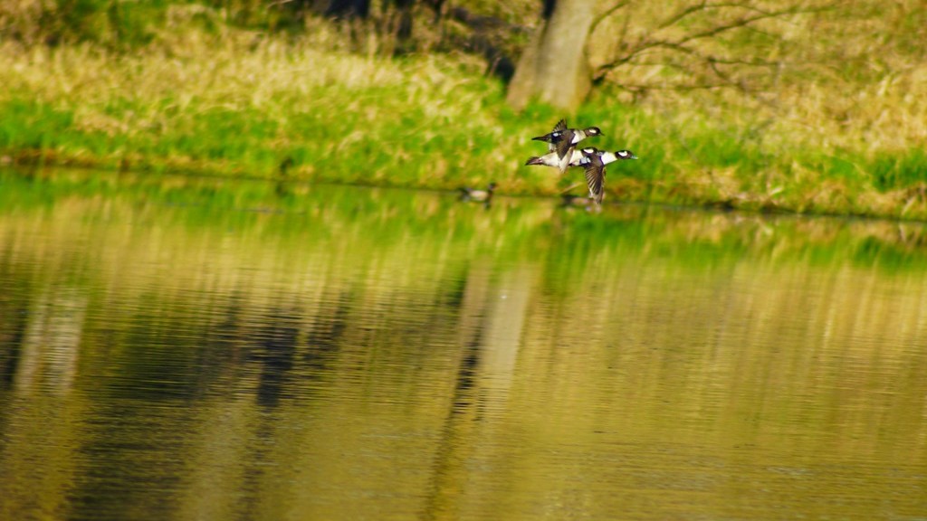
These male and female Hooded Mergansers eventually made there way closer to me providing a little entertainment as there was one male and seven females giving this group a little different dynamic from the traditional pair of ducks. It was fun as they stayed near me for a little while as they dove for food, chased each other around, and preened. Eventually they flew off to another area leaving me relaxed and satisfied with my time watching them.

Green Winged Teal

The first ducks to venture close to me were Green Wing Teals as they scoured the shoreline for food. These ducks have an amazing array of colors which become more iridescent as the light changes while they’re swimming around, however, the best colors show up as their wings are spread showing off a light teal and bright green spot on each wing. During the morning I did hear Loons calling in the distances along with Sandhill Cranes but they did not venture close enough to watch. It was a very surprising morning at this little pond with how much diversity of ducks and birds hanging around making it difficult to leave. Hopefully there will be another opportunity to go back.

_DSC7867-1

The Making of Kentucky Bourbon

Recently while on Spring Break our family headed to Western Kentucky to visit friends. During that visit we took some time to visit Jim Beam, one of the several bourbon distilleries in the area to learn how this type of whiskey is made. Their tour is quite interesting and informative making it a fun way to spend a couple of hours in a very nice facility.

_DSC7545

In order for a whiskey to be a bourbon it has to meet a couple of requirements. The first is that it is made entirely from grains with at least 51% coming from corn. These grains are mixed together and added to yeast creating a mash which is fermented for several days. Below is a photo of that mash which gets to be quite sour after a couple of days. If desired this mash can be tasted on the tour to confirm its sour taste.

Grains fermenting for several days called mash

After the mash is fermented for a long enough period of time it is then distilled separating out the alcohol in to a clear liquid which is called a white wine. At this distillery the process is completed twice to get as pure of a white wine as possible. This white wine is also called moonshine by many people.

Mulitple distillations create moonshine which is barreled and aged

Once enough of this moonshine is created and collected it is ready for aging. This is another requirement for making bourbon. Aging inside a new burned oak container. It is this burned oak that is responsible for the color of bourbon and gives it additional and unique flavoring. Below you can see how clear this moonshine is before it is filled into an oak barrel where it is stored for years before being bottled. The contracting and expanding of this oak allows moisture in and out during different times of the year altering the alcohol content and flavor of the finished bourbon.

Putting the distilled moonshine into a barrel for aging

After the appropriate amount of time aging in a burned oak barrel it is opened and tested. If more aging is required it will be re-corked and put back into storage for more time. Each barrel has a unique alcohol content as each one ages a little differently which can not be determined until it is opened. In order to get a consistent alcohol content in each bottle, multiple barrels are added together and water is used to reduce how strong each bourbon is.

Opening a barrel of Bourbon and testing it

I was amazed that in this day with all of the technology we have, wood barrels are still used and “sealed” with a wooden cork much like it has been done for centuries. It felt as though we were going back in time with these barrels everywhere. I’ve seen whiskey barrels available for planting into which I always thought were manufactured just for this purpose. Now I realize how many barrels are used in the production of different alcohols needing a life after being used in distilleries.

Corked and aging

Once the bourbon is processed so it is ready to drink it is mechanically bottled, sealed, and labeled ready to ship to distributers and retail stores for consumption by you and me. This whole bottling process is amazing in how quick and efficient it is as many manufacturing processes often are.

Filling bottles with Bourbon

We were able to tag a specific bottle and watch as it went through this bottling process making it more personal and interesting. Another requirement for bourbon is to be created in the United States of which about 95% is manufactured in Kentucky as that is where it was first discovered and made. This continues today.

Sealing and labeling each bottle

What is a tour without being able to try the product you just learned about? They have a tasting room, as there are more types of bourbon than I would have ever guessed, to see which ones you prefer. There is another area by this tasting room to order a drink or two to further try different combinations if so desired completing this very interesting and entertaining tour of a Jim Beam distillery.

Sampling the end product

Preparing thousands of bottles of Bourbon

Springtime Waterfalls

While away on Spring Break we stopped at Clifty Falls State Park in Indiana for a beautiful spring afternoon. This waterfall is on Clifty Creek which flows in to the nearby Ohio River. With sun abound and temperatures reaching into the upper 60’s Fahrenheit, it was about perfect for a hike through this beautiful state park just beginning to awaken after a long winter rest.

Clifty Falls

With ample rains providing plenty of water to glide over these limestone edges, Clifty Falls provided an amazing landscape to share with family and friends. Add to that ephemeral flowers blooming all over the forest floor and redbud trees beginning to explode with little pink flowers in the warmth of the sun overhead and it becomes almost a day many dream of on a cold winters night. Unfortunately for many people, visiting this state park in early spring does not even enter their list of possible adventures leaving these wonderful sights to those who seek out its early treasures.

Redbuds in full bloom

There are four waterfalls listed on the map for Clifty State Park however we were able to only see two of them in an afternoon providing nice incentives to return when the opportunity presents itself again. The many limestone stairs making up these waterfalls provides such a relaxing environment with their sights and sounds making the hikes to see them a worthwhile adventure.

The upper portion of Clifty Falls


Spring Waterfall

A Philippine Virtual Vacation

Luzon March 2

Recently I watched a World War II vet give a presentation on his involvement in retaking Luzon, Philippines from the Japanese. Being intrigued I decided to take a virtual vacation of the areas he described. These included landing on the beach in the Lingayen Gulf, marching through Binalonan, San Manuel to Lupao, San Jose City, Puncan, Carranglan, and ending in Santa Fe.

Virtual Philippines

My virtual vacation began with a Google Earth flight from Minneapolis to Angeles, Philippines mid January which is currently priced around $1,000. In my research January and February are the best times to visit Luzon as it’s the coolest time of year and the driest. After spending almost a complete day flying I anticipate needed some time to rest so getting a hotel and something to eat would be the next piece of my virtual vacation. There seems to be a wide range of food options to try while there.

food

The next day begins the trip of re-tracing the steps of this World War II vet in the present day. Going from Bonuan Beach which is pictured at the top the first city is Binalonan. There appears to be signs of war yet today just rusting where it was left mixed in to places rebuilt and expanded to what Binalonan is now.

Binalonan 3

Binalonan tank

Moving on from Binalonan, the next destination is San Manuel. I wasn’t able to find much for photographs taken in this area so I continued on to Lupao. This looks like a beautiful area with some mountains, farm land, and a nice city.Lupao 1

Lupao 2

Lupao 3

Nearby San Jose City is the next place on this tour re-tracing the steps of 75 years ago. This appears to be a nice city resting in the foothills of mountains which can be seen off in the distance of the second photo below. San Jose City looks like a nice spot to get acquainted with local culture among modernized buildings and vehicles. I can almost feel the warmth and humidity from the palm trees, moisture on the ground and clouds passing by. A nice break from winter weather in Minnesota.

San Jose City 3

San Jose City 2

San Jose City 1

On towards the mountains stopping in the Puncan area. I didn’t see any pictures of a town or city, just a few photos of the countryside which looks amazing. The dirt roads in the photo below may indicate difficulty in traveling through this area without a vehicle capable of driving over rough roads. Most likely a less traveled area.

Puncan 1

Puncan 2

Traveling to nearby Carranglan brings similar landscapes and significantly less development than San Jose City. A beautiful and quiet area to relax in without all of the activity of higher populated areas.

Carranglan 1

Carranglan 3

Carranglan 4

Santa Fe brings up the final city of this area as World War II ended for this vet. This seems to be more mountainous terrain with a small town winding through the hills and valleys. I wonder what the monuments in these photos are dedicated to? Again another picturesque and relaxing spot to take in the mountains of Luzon.

Santa Fe 1

Santa Fe 2

According to this World War II vet, Baguio was their final destination as they forced the Japanese out of the Philippines but thankfully the war ended before reaching this large city. I can only imagine what impact war would have on this city and how much rebuilding there has been during the past 75 years.

BAGUIO AT 104. Baguio, which has a land area of 57 square-kilometers and designed for 25,000 people, is now home to close to 400,000 people and has grown to become one of the highly urbanized cities in the country. Baguio celebrates its 104th Charter Day anniversary on September 1. 010913_baguio_05_comanda.jpg.

After listening to descriptions of the terrain the military traveled over it’s nice to be able to view photos taken to get a better idea how much the terrain changed going from flatter, wet areas to mountains. It’s also nice to see that these beautiful places have been rebuilt from the ravages of war. Time to return to Minneapolis to the snow and cold.

Bonuan Beach

Ice and Snow

After seeing bare ground for several weeks we got a light dusting of snow and cold temperatures re-freezing soft ground so I wanted to get out and enjoy a winter sunrise. After watching the sunrise my goal was to photograph Eagles, which have been courting lately resulting in some spectacular flight displays. Unfortunately I did not see any of these acrobatics on this morning but I did see some interesting natural art.

Time Frozen

There were several stumps with roots protruding from the ground covered in a light coating of snow making for fun and interesting patterns. I liked how the old tree stump contrasted with the snow and frozen creek next to it. It made me think of a landscape lost in time being frozen from an earlier millennium to be recently discovered. This is partially true as the area I was in has been covered in water for many years and recently has been drained exposing it’s true character from before it was damned and flooded. Another frozen tree reminded me of a Mammoth tusk further reinforcing these pre-historic thoughts. While my morning excursion was entertaining it was back to 2017 a few hours later.

A Mammoth's Frozen Tusk?

Signs of Spring

It seems way to early but the signs of spring continue to increase with each warming day. Every day that I’m fortunate to be able to go out into nearby woods I see spring making its way more and more. By the end of February the days have gotten noticably longer and temperatures are increasing. Most of our snow is gone and the ice on lakes and rivers disappears a little each week bringing open water and a place for migrating ducks to land.

Ice is melting away

One day last week I was out hiking when little white specs caught my eye. On closer inspection it was pussy willows beginning to emerge. This is about 2 to 3 weeks earlier than last year. I keep hoping for a late season snowstorm or two but with each passing week that potential gets further and further away. I know many people are happy about the warm days and they do make every day life easier. Still a reminder of living in Minnesota in early March would be nice.

Pussywillows emerging

Tucked away out of sight there is the occasion sign of spring such as Silver Maple trees beginning to bloom without attracting much attention along with brightly colored mushrooms sprouting from a damp log and moss becoming a lush green almost like a soft, thick carpet covering up a decomposing log. Animals are also beginning their spring rituals as they come out of hibernation while others prepare nests or dens for another year of new creatures to enter the world.

Birds are migrating North

In areas where the water is no longer covered by sheets of ice I see ducks, geese, and swans bobbing up and down as they find nourishment under the surface. This is just the beginning and March has a way of teasing spring weather and then reversing with a blast of winter stealing the motivation to venture outside until it all passes sometime in April. For now it’s fun to witness each new change as the landscape emerges from a long winter nap.

Silver Maple beginning to bloom

Climbing for Air …. American Lung Association

For a number of years now (10 to be exact) the American Lung Association has organized and event called Climb for Air. I’ve heard about it for a couple of years and thought it was cool that they would be able to use one of the taller buildings in downtown Minneapolis for it. This is a fundraising event ending with each person climbing stairs for 31 stories. When I first heard that I questioned if I would be able to accomplish such a feat.

Climb for Air event in Minneapolis

On Friday I heard of this event happening this year again and began to ponder if I should attempt climbing stairs for 31 floors to reach the top of one of the skyscrapers in Minneapolis. I’ve not been working on getting into trail condition as much as I should be so physically I’m not as prepared. Researching further 31 stories equates to about 680 steps. Once I saw that then there was little doubt if I could do this or not. There have been caves explored where I’ve climbed half that many stairs so I should be able to do this although this is just climbing up, up, up with limited breaks like a cave would have. After going back and forth I decided it would be a good new life experience for me as well as a worthwhile organization to support in honor of an uncle I lost due to lung cancer and signed up.

Over half way done

The next day I arrived at US Bank Plaza to begin my climb. Average climb times are listed as 10-15 minutes so I figured I should be able to do it 20 minutes taking my time as needed. They attached tracking tags to one of your shoes to keep track of how long it takes to climb and off I went stair after stair. I remember reaching the second floor and then the third. Before I realized it I was at the 16th floor – over half way. I stopped for a quick water break on the next floor and then there was the 19th floor. My legs were beginning to feel it a little but more so I was breathing pretty hard by this time.

From the top

Reaching the 22nd floor I tried to slow down a little for the next flight, took a few seconds to stretch tightening muscles a few times until reaching the 29th floor and decided a strong finish was how I wanted to end the climb. During this time I was thinking back to last summer’s climb of Long’s Peak and wondering how many steps I climbed for that. A few more than this I’m sure. Once getting to the top floor I was a little shocked it was done and kept walking back and forth on that floor to cool down while grabbing more water. After a few minutes I realized it took just over 6 minutes to climb 31 stories. Wow was it really that quick? It was an enjoyable experience and one I felt good doing. Marathons and bike races aren’t of much interest to me but this fits in well for me.

After completing the climb

A Snowmobiling Adventure

Last winter I had so much fun snowmobiling in Northern Wisconsin that I couldn’t wait to do it again so this year the plan was to go earlier almost guaranteeing enough cold and snow to fly across the wintery landscape. As luck would have it the upper Midwest has been relatively warm with precipitation falling as rain instead of snow once again bringing questions of trail quality and snow cover. As the planned day arrived a fresh coat of snow fell bringing many of the trails into great condition for snowmobiling. Let the fun begin!

Getting ready to hit the trails

After a brief check of the snowmobile it was time to hit the trails for a day of adventure through the forests of the North. Thankfully it was a warm winter day under a bright blue sky dulled only by a few wispy, white clouds making for perfect weather to fly on top of the snow covered Earth. As the day progressed miles kept flying by bringing different beautiful landscapes around the next corner.  Portions of the trail glide through dense forests while others are wide open fields with the occasional lake added in to keep the picture ahead changing.

Cruising along on the snowmobile trails

As sunset approached the mileage was reading almost 150 miles clocked during the daylight hours. It was definitely fun amassing those miles through every turn and hill set before us including one that was a little sharper than expected causing a sled to cruise through the corner almost flipping over and running over a few small trees before stopping to allow damage assessment. Fortunately there was none except maybe to a little tree or two which had to be removed before the snowmobile would move under its own power once again.

Taking a few moments to watch the sun set

With the sun now down below the horizon it was off towards our final destination of the day ending at a hotel for a few hours of rest before returning the snowmobiles for the weekend. As the trees flew by the sky continued to amaze with beautiful colors changing from yellows and oranges to reds and pinks distracting from the trail in front.  Fighting through that distraction came yet another one with a full moon rising above the horizon bringing with it a reminder that there was suppose to be a partial lunar eclipse but probably not visible at this Northern Wisconsin location. As daylight turned to darkness this partial eclipse shown across the face of the moon continuing the challenge of focusing on the trail ahead.

Watching a full moon rise partially eclipsed

A quick stop to refuel and off again into the darkness of trees reaching over snow covered trails meandering up and down and side to side until my snowmobile continually slowed down even though the throttle was pushed until it stopped and a small pop came from under the hood. Now what do we do here with nothing but trees as far as we could see. After a half hour of trying to get it restarted without success we decided our current adventure was complete and unknowingly a new one was about to begin.

Thankfully our second snowmobile was a two person sled so we moved the dead snowmobile off of the trail and headed for the nearest town to hopefully secure a place to stay and figure out what to do with the broken one. As the night progressed we learned how to disable the drive on snowmobiles and how to tow them all thanks to Youtuber’s. Grabbing a tow rope we headed back to the disabled snowmobile, disengaged it’s drive belt and towed it back to the rental place over several hours in complete darkness with only the flashlight of our phones to see what we were doing as the moon was now covered by a layer of clouds. Once completed we fell, exhausted into our beds for the night ending this Northern Wisconsin adventure.

Exploring the Grand Canyon

On our second Monopoly Adventure we traveled to the Southwestern United States to visit Petroglyph, Mesa Verde, Canyon de Chelly, and the Grand Canyon National Park. Grand Canyon was the last one of this trip arriving here the third week of March. As we first began planning this trip my expectation was that mid to late March would be great time to visit this area of the country as it is Arizona and should be a warm retreat from winter. Surprisingly that was a misconception as we saw snow in every park we visited.

March '10 142

Nearing the Grand Canyon you could already see portions of this formation before ever entering the park but not to the scale it is inside of Grand Canyon National Park. We arrived at the visitor center, parked the car and headed for our first view of this enormous canyon. Most of us have seen pictures of this place but those just cannot display the magnitude of the Grand Canyon. You can’t see how far down it is from the rim to the River or how wide it is from the South Rim to the North Rim.

The Colorado River running through the Grand Canyon

Once you begin to grasp just how large this place is, the details of different layers of rock and plants growing on top of those rocks creating a green contrast to the red, orange, brown, and beige rock layers making up this canyon strike you. There are numerous layers of different colors and textures showing each natural event combining to create this Grand Canyon. Definitely a beautiful sight! Even from the top of the rim you can hear the Colorado River crashing over boulders creating the large white water rapids so many like to raft over. Amazing how far that sound travels.

Looking out at the Grand Canyon from the South Rim

Even though there was snow on the ground in places and it was cooler than we anticipated it still was a good time of year to visit as there were considerably fewer people allowing us to get around faster and see more of the canyon. There are several trails throughout the Grand Canyon which would have been interesting to explore but we had already traveled on miles of trails while exploring the South Rim and didn’t feel up to climbing down a portion of the canyon and then back up. This was before we had done any real hiking to know what our abilities are. If we visited the Grand Canyon now I would definitely take off on this trail to see these incredible rock layers close up. Maybe some day I will because I would also like to camp near Phantom Ranch and see the Colorado River up close.

The beginning of the Bright Angel Trail.

Preparing for Isle Royale

In my previous post on ‘Planning for 2017’ I wrote briefly on going back to Isle Royale. I find this desire to backpack here very humorous because the last time I did this with the rest of my family I was adamant that backpacking was not for me and I would never do it again. I was glad to have experienced it once but that was enough. And now I can’t wait to return and hike further and for more days. What happened?

One of the shores of Isle Royal

Either I’ve gone crazy or have gained more knowledge on backpacking. First lets figure out why there was no desire to backpack again. Most of this came from hiking with a lot of extra weight on my back causing pain in my shoulders and back every time my pack was hoisted back onto my shoulders. The second reason is that sleeping was cold and uncomfortable leaving me tired much of the time longing for a good nights sleep. Other than that, I enjoyed the time on the island.

Getting up close to a moose can be very exciting if done safely for the animal and the viewer.

So what’s different now? A number of things have changed my opinion of backpacking bringing on an excitement to do it again. First is all of the information and experience I’ve gained since then increasing the confidence to be able to hike with extra weight and actually enjoy it. I now have a good idea of what is involved in preparing for an extended hike which includes hiking locally with a heavy backpack for a couple of miles each time along with biking a couple of days a week for several miles putting me in better shape. Also I have a nicer camera that I really enjoy using and Isle Royale is a great place for beautiful photographs adding to my excitement to be there.

A portion of the beautiful trails on Isle Royale

If I do this right the training backpack will be heavier than my actual pack making it seem like no big deal to carry all day long. Add to this increased muscle strength to be able to carry the weight while working around rocks and tree roots, using trekking poles to keep better balance and weight distribution, and bringing fewer items reducing my overall back pack weight should combine to make a fun hiking experience.

Sleeping in the solitude of Isle Royale can be difficult to get use to.

A few weeks after returning from Isle Royale the last time I began to go through our supplies and determined how I would pack differently another time to reduce the weight I was carrying. It was amazing how much different things felt for each pound we removed either in food or water weight making the pack lighter. We definitely brought too much food last time and heavy food at that. That is an easy place to reduce weight by several pounds. Also, sleeping gear last time was heavy lugging small air mattresses, cotton sheets, and blankets. This time a sleeping bag, light sleeping pad, and maybe a small pillow which should eliminate more weight. My only concern is increased weight in camera equipment so I will have to watch that part. As far as sleeping goes, I know there won’t be great sleep so I’m prepared for that so it should be less of a concern.

One of the Entrance Stations of Isle Royale

Training for hiking in the Rocky Mountains in 2016 and how successful it was and I was at completing a couple of 10 mile + hikes at higher elevations has proven to me that I can adequately train for this trip and go the distance with my backpack. In fact, at times I would even forget I was carrying my backpack loaded with clothing, food, and water all as a result of training before hand. The pack will be heavier this time as it will include more food, a tent, sleeping gear, and probably more clothing so I understand what I need to do to prepare. I’m so looking forward to this but there is much to do before then.