Tag Archives: Hiking

Independence Day on Isle Royale

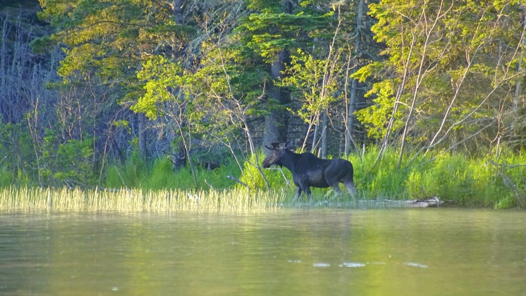
After the close encounter with moose the night before, it was nice to get back to camp and crawl into the sleeping bag for a night of much needed rest. Beginning to return to a conscious state, I eventually realize I’m hearing water splashing. Now more alert I open my eyes and realize this is Isle Royale and Feldtmann Lake is steps away from our tent. That must be a moose I’m hearing! I try to exit the tent as quietly as possible, grabbing my camera on the way out and take the trail out to the shores of the lake. There he is entering just a short distance down the shoreline walking in the opposite direction. Amazing to see this large, wild animal right there in front of me. I crouch next to a small shrub and just watch as the moose meanders towards deeper water, finding something to eat from time to time. Hoping to see at least one moose on this week long adventure and here it is only the second morning and my count is already at five. I know there are a lot of moose in this National Park, but to see that many in less than 24 hours seems almost surreal. Eventually this moose moves on and I turn my focus to other wildlife around.

A pair of loons on Lake Feldtmann

Off and on through the night and early morning hours I would hear the call of a loon. Relaxing near the shore, a pair of loons swim closer searching for breakfast and giving the occasional loon call echoing down the lake. While enjoying their company I realize it’s the 4th of July. Our plan was to stay put near Feldtmann Lake for the day and just enjoy the day. Maybe catching fireworks from Rainbow Cove at nightfall shot off from Grand Portage. We had a down day planned just in case weather did not cooperate at some point or we were to sore from the 9+ miles of hiking to get here from Windigo. Fortunately we felt relatively well and the forecast called for passing storms in the afternoon with clearer days after so we could spend the day leisurely exploring around Feldtmann Lake. As the loons moved out of sight I turned around to return to the camp sight beginning to feel my stomach beginning to growl. Before I could go just a few feet I noticed a dragonfly soaking up the warming sunlight. They are such interesting insects and eat mosquitoes which is a great benefit on this island.

A dragonfly warming in the morning sun

Eventually I return to the campsite and the others make their way out for the morning. Time to enjoy a warm treat today. Most days its just bars and dry cereal. Things we can eat while on the trail. After breakfast is over and our dishes are all cleaned up, we notice the other hikers have all left and we’re the only ones left. We decide to check out the other campsites and decide there’s one we would rather spend the next day at. The tent gets emptied and flattened so we can transfer everything a few sites down the trail and be right on the shore of Lake Feldtmann. One of the advantages of taking a day off from hiking. Once everything is set back up we decide to enjoy the view on this beautiful, sunny morning. Watching the water for awhile and we begin to see fish. There’s supposed to be Northern Pike in the lake. Then Kristen pulls one of her feet out of the water and there’s a leech attached. Bait? What can we do for a hook? Then I spot a lure stuck on a large stick under the water. I retrieved the lure and tried to save the fishing line attached without success. We took some of our rope, attached the lure adding the leech, and tossed it out. Unfortunately this wasn’t successful. No fresh fish for dinner tonight.

Relaxing by the lake

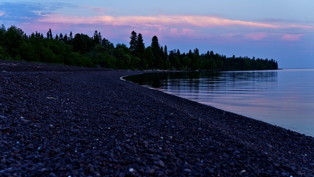
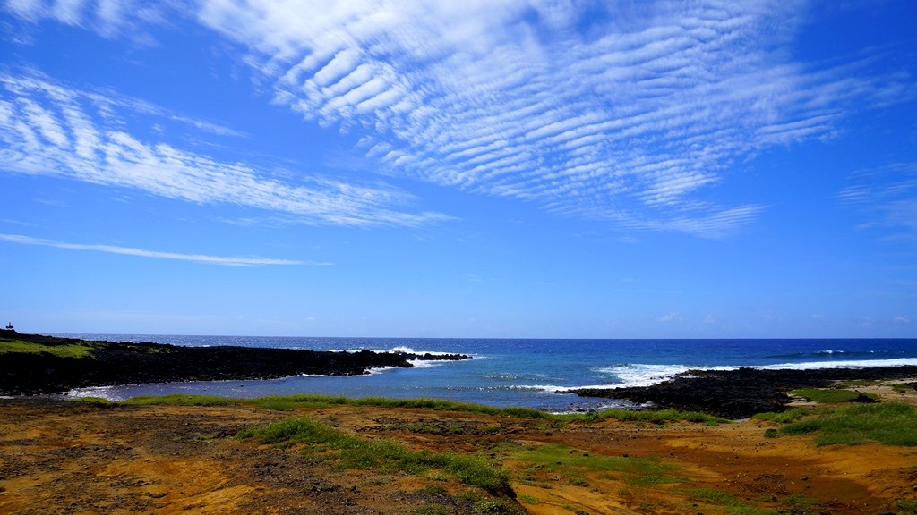
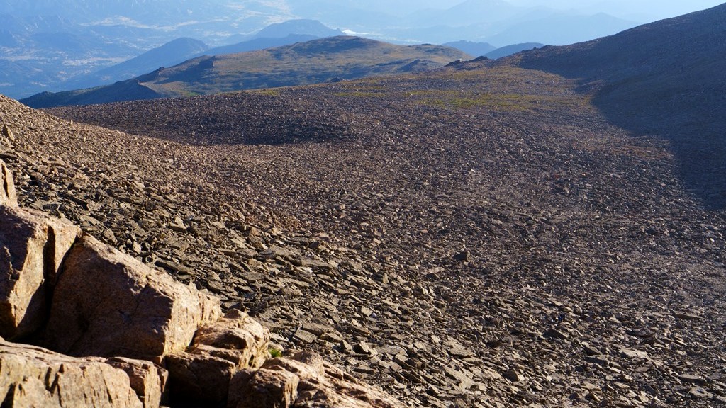
At one point a beaver would swim by at relatively close range and climb on shore just on the other side of our tent. A minute or so later it would return to the shoreline eating the leaves it just collected near our tent. They’re fun to watch close up but also a little unnerving. Their teeth as so big and sharp. They could clip through a bone with ease. Thankfully they really don’t want to attack humans so we could just watch them going back and forth in the lake without too much concern. I wasn’t sure how we would spend a down day. Would it move slow and boredom set in? Instead time was flying by and here it was lunchtime already. We prepared our Independence Day meal and enjoyed it in this amazing park. Afterwards we decided to wade in the shallow water near the campsite. The water felt great on our recovering feet from the hike the day before. Fish would swim just out of reach, including a few Northern Pike we’d heard about. Exploring the shoreline a little we looked at the vegetation moose seemed to graze on and could even see their hoof prints in the sandy bottom. After an hour in the water we decided to return to Rainbow Cove almost a mile away and take in the waves of Lake Superior while checking the western sky for rain and thunderstorms.

Up close with a beaver

Beaver eating breakfast

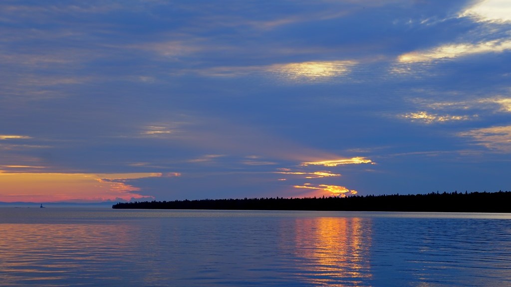
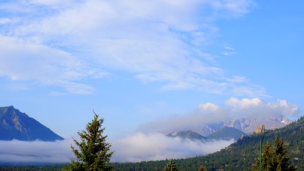
By this time clouds began to increase with some fog beginning to drift into Isle Royale. A crack of thunder could be heard off in the distance but there really didn’t appear to be any storms approaching. It must be moving around the island keeping us dry. We walked up and down the beach at Rainbow Cove for awhile just looking at the different stones and listening to the water splash against the rocky shore. Eventually we decided that fireworks probably would be covered by the clouds and fog and headed back to our campsite for the remainder of the night. As we got back there was once again a frenzy of hikers setting up their campsites after a long days hike. Several of them were disappointed as they tried to get to Feldtmann Lake early in order to get the best site but we were already there. A part of me felt a little bad because I understood their extra efforts to secure this beautiful spot only to have it already taken. The night began to overtake the day and we decided to head for our sleeping bags once again bringing an end to our Independence Day on Isle Royale National Park. Tomorrow would bring a 10+ mile hike further into the island.

Skipping rocks at Rainbow Cove

A Trip to Rainbow Cove

As our first day on Isle Royale was coming to a close we decided to take others advice and head to Rainbow Cove on the eastern edge of the island to watch the setting sun to the west out over Lake Superior. After hiking 9 miles with heavy packs on our backs, hiking nearly another mile might seem a little too ambitious. Surprisingly, after a little time sitting at camp, the soreness in my legs and back disappeared although the energy level was still low after a long day getting to the island and getting to Feldtmann Lake were we were camping for the night. This was probably the only chance to catch a sunset here so if we didn’t go we would miss the opportunity even though we were actually staying in this area for two nights. The next night clouds were expected to cover the sky with possible rain showers or even a thunderstorm so off to Rainbow Cove we went. Without all that weight resting on our shoulders it actually was a nice hike over beautiful terrain.

Something just doesn't seem quite right

Along the way we enjoyed all of the blooming flowers, smell, and scenery of the north country trapped in Lake Superior. At one point during a conversation I turned to look back at my cousin who was walking behind me and out of the corner of my eye, I noticed something didn’t seem quite right. Quickly looking back I realized we were being watched by a moose. I kept walking until there was a larger tree between me and this moose which was just standing there watching as we passed by. Now having a little protection, the question was to keep going as we were really too close to this animal or stop and watch and possibly capture a photo or two. Well, given the pictures above and below you can guess what we did. Fortunately this particular moose didn’t seem real interested in defending her area and just continued to watch us while we watched her back and snapped a few photos. While taking in this lucky encounter, another hiker came behind us. He stopped abruptly once he looked up and saw we were stopped, looking at something in the woods. I could tell when he realized what we were looking at by the surprised look on his face from being so close to this large animal. Moose have been know to be quiet aggressive and with their size can cause substantial harm so we didn’t stay too long. Besides, the sun would be nearing the horizon soon. Back to the trail.

A moose on the side of the trail

Eventually we made our way to Rainbow Cove and collapsed on the beach. What a great spot to just sit and relax, listening to the gentle waves wash up against the pebble filled shoreline as the sun continued it’s trek toward the horizon. After some time had passed and other hikers began to join us on the beach I decided I should try and capture a few photos since I did drag the camera and tripod all the way here. Wanting to just continue sitting and enjoy the surroundings, I knew I would regret it if I didn’t come back with some pictures to remind me of the experience. Picking up the camera I began to try a few different compositions but my energy wasn’t truly up to the task. There are a few shots that show just how beautiful this area is even still. The setting sun was blocked by several clouds so the colors I had hoped to see, and photograph, didn’t materialize like I’d hoped. It was a worthwhile adventure regardless.

Sunset at Rainbow Cove

As we were just about ready to work our way back, something appeared to be heading our way along the shoreline. As it approached we could tell it was another moose stopping to munch on some leaves while working its way up the beach. Now what do we do? The best thing to do when a moose is near is find a tree to stand next to and keep still. Here we are exposed on the beach. A moose is a much better swimmer than we are and would be able to out run us into the trees a short distance behind. With nowhere to really go we watched as the moose continued closer and closer. It seemed as though the moose didn’t really care about the National Park Service’s rules about how far to stay away from these animals as this one was clearly in violation of it. Finally, as it got uncomfortably close it heading back into the island. Unfortunately it happened to be close to the trail we needed to take back to our campsite. Waiting for about 10 minutes or so we figured it should be safe to head back as this moose should have moved far enough away from the trail. We were in luck!

Getting back on the trail there was no sight or sound of this large creature. Finding our pace towards camp, I walked past a large group of shrubs and immediately saw the moose again. It was facing away from us while continuing to eat until it saw me at the same time. In a moment it was turned towards me and charging. I quickly moved back behind the shrubs I’d passed and the moose stopped. Waiting another 5 minutes, my cousin decided to see if the moose had safely moved on. He slowly moved to the clearing away from these shrubs looking for the moose. It was still there facing the opposite direction eating. Again it turned quickly and charged a second time. Immediately he retreated behind the shrubs once again and the moose stopped just like before. Now I was getting concerned as it was getting dark and our flashlights were back at camp. We intended to be back before dark overtook Isle Royale. Who expected to be trapped by a moose this long? Another 10 minutes passed and we tried again. This time the moose was gone thankfully. I enjoy seeing these moose but not when one is being aggressive as night is approaching. With just a hint of light still in the air we made our way back to camp for the night and crawled into the tent. What an amazing first day on Isle Royale!

What do we do now?

Hiking to Feldtman Lake

And we’re off! The Feldtman Lake Trail is listed at just under 9 miles from Windigo and we have no real good idea how our group will perform. How many stops will we need? What pace can we maintain? Our goal is to get our camp set up before dark reaches the island. It was almost noon when we started and sunset was about 10pm on the island so ten hours to make it there. On our last Isle Royale adventure in 2012, we averaged 1.5 miles per hour. That was seven years ago though. If we can maintain that average we should be able to complete nine miles in six hours which would get us to the campground about 6pm. Plenty of time to get set up and cook food before the sun falls below Lake Superior.

The start of Feldtman Lake Trail

The first two miles of this adventure were familiar because on the first day of our last Isle Royale trip we explored the area to an overlook on this exact trail. I knew there was a fairly steep climb leading to the overlook for our first nice challenge. The overlook would be a good spot to rest with the packs off for a short time and let us know where we are for speed. Fortunately our energy was high and the trail was beautiful with plants at peak flower causing me to forget about the weight on my back from time to time. There were even a few different types of orchids in bloom which was really exciting to see. After the first mile we began to head up in elevation causing us to really become warm after shivering on the boat ride to the island. Now I get to see if all of my preparations to be physically ready paid off. There was a bit of a strain on my legs in this section of the trail and my breathing became quite labored just before reaching the summit but all in all I felt pretty good. Like I could make this hike reasonably well.

Spring flowers in full bloom along the trail

Reaching the overlook, I checked the time and saw our pace was at my expectations. And the nice part was the rest of the trail is downhill. Finding a spot to set our backpacks down, we grabbed a drink of water and admired the view (photo at the top of the post). After a few minutes of scanning the island from this high point we sat for a few minutes and found some food to keep our energy levels up for the remaining seven miles. Feeling good and a little anxious to see what lies ahead, we hefted our heavy packs back on top of our shoulders and continued on. There were a few ripe wild strawberries in the are so I  harvested a couple for a nice little fresh fruit on the trail. Quite tasty although barely the size of a pea. It would take a lot of these for a nice meal. Up on the ridge the temperature was estimated to be in the upper 70’s Fahrenheit so it was warm and we were now hiking in the sunlight.

One of the many obstacles on this trail

Thankfully the shade of trees arrived a short distance later helping to keep us cool. Although they also became obstacles from time to time which we happily overcame. A downed tree was a great place to lean against and take much of the backpack weight off of our shoulders from time to time revitalizing our legs and backs before continuing on. Over the course of the afternoon we would stop every couple of miles to remove the heavy weight being carried on our backs, grab something to eat quickly, and sip some water making sure to ration so there was enough until we could refill. About halfway to Feldtman Lake, the thimbleberry bushes began their attack. These are fairly tall bushes with stiff branches and large leaves which continually ate at our legs leaving behind some nice gouges for us to remember them by. As we continue to move we only encountered one other hiker headed towards Windigo and two hikers on their way to Feldtman Lake. They passed us during one of our breaks to regain the lead. We caught up to them again right at Feldtman Lake.

Our campsite at Feldtman Lake

I had decided it was time for another break and sat down briefly to find a little relief from my backpack as the weight was really causing soreness in my shoulders and lower back. Also I wanted our group to be rejoined to make sure everything was going ok. A few minutes passed and looking at a clock and miles already hiked told me there should only be a small portion left ahead. That was all the motivation I needed to put the pack back on knowing it should only be for another 20 minutes at the most. As it turned out, I turned a corner and saw the metal sign showing the location of all of the campsites. We had made it! Moving towards the campground, there was an open site but wasn’t right on the lake so we kept looking. There were a few others open but this first one we spotted seemed like the best remaining place to pitch our tent so we walked in the cleared area and set our backpacks down for the last time on this day. What an amazing feeling! It was like I was walking on air or had springs in my shoes without that thing attached weighing me down. And it was just after 6pm so there was plenty of time to enjoy camp yet.

The first moose sighting

A few minutes after setting down the packs and pulling out the tent, a moose was spotted not far away in Feldtman Lake. We headed to a nice viewing spot to take in some wildlife viewing and relax for a moment. I had hoped we would see a moose or two on this adventure and here one was to welcome us to our first camping spot. After a few minutes, the moose headed back into the woods so we returned to our evening chores of getting the tent set up with sleeping pads and sleeping bags. Once complete we began preparing our one hot meal of the day talking about that days adventures and what we wanted to do with the few remaining sunlit hours. A trip to Rainbow Cove was recommended by multiple people so that seemed like a good way to end our first day on Isle Royale.

Map of the days hike

A Return to Isle Royale

It’s been too long since the last time backpacking on Isle Royale. A trip was planned a couple of years ago that had to be canceled but finally, this summer we were able to return. It’s a little weird writing that since the last time, in August 2012, I was very certain I never wanted to return and do another backpacking trip. Funny how things change. This time I was so excited to see the island again. To be immersed in it’s wilderness and to hike the route I originally wanted to hike the last time – The Feldtmann Loop. Thankfully we didn’t hike this route last time as it requires some dedication and is more physically challenging. I wouldn’t have enjoyed it. Carrying a very heavy pack and never having backpacked before would have made it an awful experience I think. Hopefully I’m better prepared with a little more knowledge and can enjoy such a physical adventure.

Just about to board the Seahunter III

Waking up early after a late night of traveling to Grand Portage, if there was any sleep this past night, the nerves began to set in. Because there’s a time change just to the east of Grand Portage, our phones were reading a different time than the hotel clocks. Which one was right? We have to complete our packing and get to the ferry docks to begin a day of hiking. The trip takes about two hours which gets us to the island mid-morning. Will we be able to make camp at Feldtmann Lake before dark? How will we do hiking 9 miles with backpacks much heavier than I wanted. Mine was over 40 pounds and I was hoping to have it at 30 pounds or less. I remember being miserable with such a heavy pack the last time with a sore back in multiple places, sore feet, and legs and that was only 5 miles. We made it to the docks with plenty of time and even stopped for breakfast to eat on the way. Our packs were finally fully packed and loaded into the boats storage area and it was time to just enjoy this moment. I couldn’t tell if I was more excited or nervous. My youngest daughter was with me and she was somewhat hesitant to come on this trip to begin with. Would she enjoy it with the more extensive hikes and more weight? She was afraid to be the weak link in our hiking group and feared holding us back. I just wanted to have this time with her and for her to have a great and memorable experience. Sharing this time with her was something I had been really looking forward to so now it was time to just take in the moment and be thankful for this tremendous opportunity.
The ancient and sacred Little Spirit Tree

Just before boarding the crew informed us that the water temperature was in the low 40’s Fahrenheit and it would be a cold trip so bring some additional layers to keep warm if we had them. I grabbed my fleece coat for additional warmth but anything else would require unpacking so I decided to endure the couple of hours of gliding through the cold waters. Shortly after departing the docks the ferry tends to stop for a short view of the Witch Tree, also known as the Little Spirit Cedar Tree. It is a gnarled old tree estimated to be over 400 years old growing out of the rocks on the shoreline of Lake Superior near Grand Portage, Minnesota. This is a sacred tree to the local Ojibwa. I’m always amazed to think something can grow, essentially in rocks, and endure the extreme winter weather for such a long period of time. And now it was time to turn and continue our journey towards Isle Royale.

Isle Royale is visible on the horizon

Off on the horizon you can begin to make out the tree line of this National Park. It’s hard to believe it takes so much time to travel this distance but that’s because it’s surprising how far away it really is. The trip covers 22 miles of Lake Superior. It was difficult to remain calm and try to enjoy our journey but I was nervous about the days hike and just wanted to begin. About halfway the cold waters began to make there way through our jackets as we began to shiver. The crew was absolutely correct about the journey being cold. Not that I thought they were wrong to begin with. I wrapped my arms around Kristen hoping to bring some warmth to her. I didn’t want her expending additional energy just trying to stay warm. She would need it later. In a few hours, I knew we would all be hot once again and just kept telling myself that the cold air was only temporary and to continue to enjoy the sights and our time on the boat as much as possible. About half way the Rock of Ages lighthouse became visible and a marker telling us how close to the island we were.

Entering Washington Harbor

Soon the lighthouse moved from east of the boat to west as we passed into the National Park. The details of trees and stone creating this incredible landscape became closer signaling our arrival back to this beautiful wilderness. The nerves were beginning to give way to excitement and the cold was being chased away by thoughts of wildlife and wildflowers. Would there be wild orchids in bloom on our paths? Would we see another moose this time? How about a fox or even a newly placed wolf? Engines started winding down as we entered Washington Harbor. The shoreline began to have a familiar look. The trees still had their bright, spring green appearance as though the snow only left a few weeks ago. More and more I was certain it was a perfect time to live on Isle Royale for a week. Soon we slowed down to gaze through the clear waters of Lake Superior at the USS American. One of many shipwrecks around this large island. After a few minutes of observing this underwater treasure, we were once again headed for the docks to disembark for our journey. In a short time had our backpacks again and needed to check in with the ranger station informing them of our hiking plans before beginning. Filling our water bottles, lathering on the sunscreen, and taking advantage of flushing toilets seemed like a good idea before donning our packs and leaving this relatively modern spot for the wilderness over the next week. A few quick photos to mark the beginning of our journey and it was finally time to grab the hiking poles. Are we ready?

Arriving at Windigo ready to begin another adventure

The Green Sand Beach – Hawaii

While spending some time on the Big Island of Hawaii there are numerous things to see and do and one of those items is to walk on the green sand beach. This is becoming more and more popular for a number of reasons. One of those is that this is one of only four green sand beaches in the world making it very unique. Another is getting there has become easier due to transportation availability. You can choose to pay for a ride unless you have a 4 wheel drive vehicle, which is definitely required, or you can hike the 3 miles one way to get there.

Walking to the beach

Our group decided to take both options. Some payed for a taxi ride both ways, some used a taxi for one direction, and others hiked both directions. These “taxi’s”, which are 4 x 4 vehicles, cost us $15 per person round trip or $10 per person one way. They save a lot of time and make this beach more accessible which is both a good and bad thing in my opinion. I chose to hike both directions because the scenery is incredibly beautiful and I’m able to physically handle this hike. Just remember to bring plenty of water to drink and sunscreen or this can turn into a miserable experience. In the photo above you can see the views  while walking next to the ocean. On the right side of the photo is the trail leading from the boat landing, where this journey begins, with a few people walking over the ridge. Unfortunately they are pretty hard to see due to the size of the photo. In the very top picture you can see the beginning of the trail with a boat landing in the little bay. Again the boat landing is difficult to make out in this photo but you can see buoys in the water directing boats into the landing.

The first view of the green sand beach

After walking over some fairly rough terrain for over an hour due to many distracting views along the way we came upon this beautiful sight of the green sand beach. Once these amazing views were taken in I was surprised at how small this beach actually is and how steep the climb is down to the beach itself. I was quite warm by this point and ready to get into the water so we quickly made our way over to the trail down to the beach and went plowing into the ocean waves. The sand is very soft and felt nice on bare feet while working towards the salty water.

Down on the beach

There was only a little over an hour to enjoy this incredible Hawaiian beach so not much time to really explore the area around it. Once I had cooled off in the ocean there were some pictures I wanted to take while here so I dried off and grabbed the camera to remember how beautiful it is from a distance and up close. The water is such a beautiful turquoise blue, the rocks are interestingly carved by the ocean waves, and the sand is an amazing blend of green, white, and black grains which you can see in the image below. These green particles apparently are from lava mixing with certain minerals as it flows from the earth and deposited in this remote location. There’s a better explanation of this on this USGS page. I could have spent a lot more time taking in this beach but there were other sights to continue on to so it was time to return to our car and head to the black sand beach.

Close up of the green sand

Minnesota’s Forest Coral

I wanted to photograph the frosty plants on a foggy November morning. By the time I got all of my gear and began hiking the temperature warmed enough to melt much of the frost and with it, my goals for this day. Kicking myself for not moving earlier I begrudgingly continued on my desired hiking route just to enjoy the day and see if there was anything interesting along the way.

Great color combinations and textures of some mushrooms

My hope was to hike to a more secluded lake and photograph migrating ducks if nothing else caught my attention before hand. As I moved along the trail I happened to see this mushroom covered log. For some reason I’m drawn to mushrooms on a log. All of these rounded little plates sticking out from a disintegrating portion of wood. Yet through a number of attempts there haven’t been any interesting photos from any of my attempts. Although I’ve not had some of the equipment I brought this time either since my original plan was to photograph frosty crystals as intimately as I could. Maybe that same idea would bring out what attracts me to these mushrooms.

The amazing texture and color of lichens contrast nicely against orange mushrooms

As I neared the log I was amazed at the incredible display being put on by these mushrooms which happed to also be surrounded by lichens putting on their own colorful display on this cool, wet late fall day. The seemingly random textures of the lichens made them very intriguing along with their beautiful variations of colors, from bright greens to light blues made them stand out among the multicolored mushrooms. When I returned home later and looked on the computer they looked just like a coral reef to me.

Stepping along some mushrooms full of great texture

Throw in a little dark green moss and it became a world all it’s own. What else lives among all these vibrant formations? Eating mushrooms or lichens, seeking shelter in the many crevices? A dew covered web confirmed this little world most of us never even know of. I loved all of the fuzzy rings stacked on top of one another creating each mushroom for the spider to climb searching for its’ next meal before succumbing to winter.

Dew covered web connecting mushrooms

As I continued to explore around the fallen branches I came across some vibrant orange mushrooms which contrasted beautifully with the dark lichen covered bark. Patterns within these mushrooms amazed me along with their shapes and waves. Add to that the green, yellow, and blue lichens and this scene is just exploding with color.

An orange mushroom showing bright in late November

Eventually the daylight was getting dimmer making it more challenging to photograph these mushroom filled branches so I packed up and headed back for the car. On my return hike rain began to fall so it was a good time to leave and pack away the camera. A great substitute for missing most of the frost covered landscape. In the picture below you can see the fallen tree that first caught my attention. Very easy to continue on walking as this is a pretty common scene in a forest. Glad I stopped to examine it closer.

Mushrooms covering an old downed tree


Climbing Longs–A Reflection

A good gage for me of if I liked an experience is would I do it again. Would I hike/climb Longs Peak again? It depends on when you asked me. For a couple of weeks following I would’ve told you I was glad I did it but probably would not do it again. Asking a couple of months later I would definitely consider doing it again if the opportunity arose in the next couple of years. Maybe that’s me just being stupid and forgetting how strenuous the hike is even before getting to the keyhole and how difficult the thinner air above 10,000 feet makes this hike. Being stupid or not I know now what to be prepared for.

The amazing sunrise alone was worth the hike to this point

For 2 days following the hike to Longs Peak I had difficulty walking because of pain in my legs. Getting up from sitting and sitting back down were functions I lacked without assistance. I credit this to going 6 miles downhill at a fast pace without taking breaks allowing my legs to gain adequate oxygen while trying to avoid the surrounding storms. The other piece that took away from the enjoyment of this hike was difficulty in breathing for much of it. It felt like I was always gasping for air whenever I wanted to climb after passing the Boulder Field Campground. It would not have been as demoralizing if there wasn’t a timeline due to storms and my ride at the trailhead pre-scheduled without a means of contacting my ride to re-schedule allowing for more enjoyment of a slower pace. I was unsure of my abilities in these conditions so I had to estimate a pick up time which turned out to be too early in the afternoon.

One of the beautiful waterfalls we passed in the night on our way up Longs Peak

While on the mountain trying to decide if we should continue on from the Trough or not I kept trying to determine if I would regret not summiting if that was the decision we made. Well, it’s been a couple of months now and I do not regret our decision. For the conditions it was the right call for us. It likely would have taken us an additional 2 hours to summit and make it back to our position above the Trough. We would have gotten caught in increasingly difficult conditions due to storms in our descent increasing the risk of injury or worse. I wish the conditions would have allowed us to continue to summit but that just was not our situation. There is such a great respect for those that take on this climb after having done almost all of it.

One of the many views from the top of the Trough

Upon completing this adventure I could not figure out how I felt about it. Was it worth all of the effort required to do it? I now feel a huge sense of accomplishment and satisfaction tackling Longs Peak. It was completely worth the work, pain, and dedication to climb this mountain. What an unbelievable experience and to have been able to share it with my oldest daughter is priceless. It would have been great to also share it with my youngest daughter but that would have been more than I could handle on my own given the risks involved above the Keyhole. The scenery was so beautiful and peaceful both on the way up in the serenity of a moon lit landscape and the way back down as the mountain tops turned white from the snow while we got rained on. It must have been a great accomplishment as I’m considering a hike to the top of Mauna Loa on our final Monopoly adventure to Hawaii Volcanoes National Park which surprisingly tops out at over 13,600 feet. Additionally I monitor the Longs Peak trail conditions and webcam having a more intimate relationship with this mountain now. I love adventures and this was an amazing one!

The Rocky Mountains from Longs Peak


Climbing Longs–Continue On or Not?

While taking in the views sitting in the Keyhole, Lysa and I discussed the next portion. Are we up for the next portion of this hike, which becomes a climb, and is considered more difficult than what we just completed. Our initial decision was to sit and enjoy our surroundings and return to the trailhead while the weather was in our favor as storms were predicted for the entire afternoon and clouds were beginning to form. You can see in the above picture of the next portion of our hike. There is a group following the trail towards a valley called the trough. Actually the trail looks fun except for one issue – being able to breath adequately at 13,000 feet. Going beyond the Keyhole the hike becomes increasingly more dangerous as a wrong step on parts of the trail can lead to serious injury and even death as has happened here before.

Sitting and enjoying the awesome surroundings while watching others maneuvering the trail was nice but a feeling kept burrowing deeper inside us. What’s it like on this trail and what’s around the corner that we can’t see? Well there really is only one way to find out! On went the packs as we moved to boulders making up the trail which is marked by red and yellow bulls eyes. The morning sun was warming us at the Keyhole but as we began this portion it was in the shadows with colder temperatures. Thankfully we had gloves as the boulders are quite cold up here. The trail wasn’t too difficult as long as you take your time and watch your step while grabbing boulders to maintain balance and support among this unforgiving granite.

Making our way to the Trough in the background

Time flew by as we slowly made our way up and over numerous rocks towards the valley called the Trough. There are a few challenging boulders to climb over but for the most part it was a nice climb/hike. Reaching the trough fatigue was beginning to set in.  This is concerning because it can lead to poor decision making in a place intolerable to it. Even though we took a few breaks along the way we needed to stop for a longer period of time to regain our oxygen levels and leg strength before the next section which requires continually climbing up.

Clouds continued to build around the mountains causing us to try and push towards the top so we began climbing the Trough as quickly as possible. About a third of the way up we began to get light headed and dizzy at times along with trembling legs. At this point we knew we had to slow down and take more breaks in order to get enough oxygen to continue our climb. After this point we would climb about 10 or 15 feet up and take a short break. That seemed to help maintain our strength but slowed down our climb. While we were climbing up there were others working their way down sliding from time to time making us realize up may actually be safer than coming back down. Occasionally a rock would come flying down towards us from other hikers above requiring us to take cover from time to time until the rock passed without incident. Eventually we picked our way through the rocks getting close to the top of the Trough reaching, what at first glance, was an impassible boulder. Taking some time to study our options we chose a path and nervously worked our way up and over this boulder and arrived what felt like on top of the world. There’s a geological marker here stating that we had made it to 13, 749 feet. Only 500 feet left to the top of Longs.

Climbing the Trough

We sat on a narrow strip of granite taking in our surroundings and resting after this energy draining climb up the Trough in preparation for the next section. Again the discussion arose of continuing towards the summit or not. After a few minutes we came to the conclusion it was time to call it a day and turn around. There were multiple reasons for this. First, clouds were continuing to get darker and there were obvious rain showers in the distance working towards us. Next, we had someone picking us up from the trailhead at a designated time and looking at the current time we were already going to be pushing that time. Finally we were very fatigued and still needed to climb down these difficult sections safely. I estimated we would need another 2 hours in order to make it to the summit and begin our descent which I was not interested in doing in thunderstorms with wet, slippery rock. Especially with my daughter.

The view from the top of the Trough

After taking some additional time enjoying the view, eating and drinking to replenish, and resting to re-gain strength, and talk with other hikers about the situation we began the climb down scrambling around this almost impossible boulder while others tried to figure out their way around it climbing up. With their assistance we made it down safely over this boulder and continued down the Trough making our way to the Keyhole once again. It felt good to be back to this point safely before any rain started to fall. Taking the last few minutes at this altitude we surveyed the area as it’s so incredible knowing we will not likely be back here again in our lifetime.

Taking in the views

Shortly we made our way down to the Boulder Field campground feeling good about what we accomplished and that it’s all down hill on relatively easy trails from here just as thunder began rumbling off in the distance. Better get moving in an attempt to reach the tree line before storms reach us. We didn’t make it far before thunder began to boom overhead bringing with it a rain/snow mix which we hiked in for the next couple of hours. Fortunately there wasn’t visible lightning striking the mountains allowing us to continue our hike instead of seeking out a depression along the trail to take cover in. Yes, the decision to forgo reaching the summit now seemed like a good call as we would have been caught somewhere above the keyhole on wet boulders or possibly snow as the mountain peaks around us were turning white making the hike even more dangerous and time consuming. The rain passed as we reached the tree line with only a few more miles to go before meeting our ride and the end of this adventure filled and tiring day.

Approaching rain/snow and storms

The return brought us down over 6 miles almost without stopping in an attempt to reach safety with storms expected much of the afternoon and then to reach the car. Because of this our legs became increasingly more sore with each step down we had to take. If we would have taken a few breaks to rest we would have been in good shape having accomplished an amazing hike.


Climbing Longs–The Keyhole

Now at the Boulder Field Campsite we were able to take in some of the surroundings, enjoy a little camaraderie with other hikers attempting to do the same thing, and use toilets in preparation for the next portion of our morning hike. (To catch up with our journey thus far click here to read the previous story.) It was noticeable how much colder the air was here. Even though we were almost the same elevation as the top of Flattop Mountain it seemed much colder to the point of being able to see our breath from time to time. Fortunately the sun was quickly warming us up. While studying the boulder field it became obvious that these boulders filled in the keyhole and more at one time. What natural event occurred causing this part of the mountain to crumble forcing all these large pieces of rock to fall making a river of boulders and leaving this keyhole? Was it ice, an earthquake, or something else?

Looking up at the boulders to be climbed to reach the Keyhole

As I scanned around I kept wondering how can the remaining portion of this hike to the summit be all that difficult? It didn’t appear to be all that long distance wise or a great elevation change from the boulder field. Of course elevation is a major factor for those of us not use to it. After 15 minutes or so we decided to continue on towards the Keyhole. There were several other hikers that climbed up ahead of us providing information on the climb we were about to do. Watching from a little distance it appeared they were going up fairly slow and taking their time. I’ve climbed over rocks before and it doesn’t take that long to continue upward.

A marmot coming to be pet with a hiker in the background climbing boulders

We decided to pack our trekking poles away as they weren’t likely to be much help on the boulder terrain and lifted the packs back onto our backs ready to continue. For this section of the hike on Longs you are basically boulder hopping. Stepping towards the next boulder hoping it’s stable while making your way increasingly higher. At least that’s the plan as it’s easy to just stay at your current altitude and just go sideways if not paying attention. Quickly you begin to realize the altitude makes things increasingly difficult simply because the thinner air causes problems getting enough oxygen to breath normally. It feels like you are running and out of breath after a short time slowing down the pace. Now it makes sense why the hikers ahead of us appeared to go so slowly up into the keyhole. In addition, the higher you go the larger the boulders get and the steeper the incline gets. Looking at the photo above you see a marmot that seemed to want to get pet. In the background is a good comparison of the boulder size next to a hiker.

Exploring the vaille

Getting closer to the keyhole we reached the Agnes Wolcott Vaille built as a place of protection from storms for those attempting to reach the top of Longs Peak. Finally almost there! A few minutes exploring this shelter and it was to the keyhole to view out over the Rocky Mountains. We’ve reached the main goal of this adventure – the Keyhole!

One of the views from the other side of the keyhole

Many hikers ahead of us proclaimed the amazing views while perched among the slim layer of rocks forming this keyhole continuing to encourage those below to reach it. They were right about the incredible views sitting in this unique rock formation. From both sides of the keyhole the landscape humbled us with its beauty and vastness. We felt so small among these huge boulders forming large mountains. It seemed to take forever to climb from the campground into the keyhole but according to the timestamps on the photos taken it only took us about 20 minutes or so to complete. While sitting in the keyhole eating a Clifbar and drinking more water we examined the next portion of trail that would take us to the summit of Longs Peak if we felt up to the challenge. I think the expression on Lysa’s face in the picture below gives a good idea of our thoughts! To continue on click here…..

Sitting in the Keyhole studying the next portion of the trail